| |
|
 |
|
|
|
| |
Information and reservations: |
| |
Phone:
+34 972 980980 |
| |
Email:
info@roses.net |
|
|
|
|
| |
|
|
 |
|
|
|
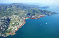
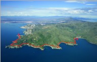
Information
and photos from the Tourist Office of Roses. |
|
For those who
like trekking and nature, Roses has five very well
signposted and accessible routes forming part of a unique
and natural setting created by a perfect combination of sea
and mountains.
Roses paths
brochure |
|
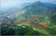 |
Route
1 ●
Farmlands
|
APPROXIMATE DURATION: Option A. 2 hours
30 minutes | Option B. 3 hours 20
minutes DIFFICULTY » Medium
●
PLACES OF
INTEREST » Traditional olive trees,
reservoir, stone pine and Holm oak
woods, traditional farmhouses.
●
More information
|
|
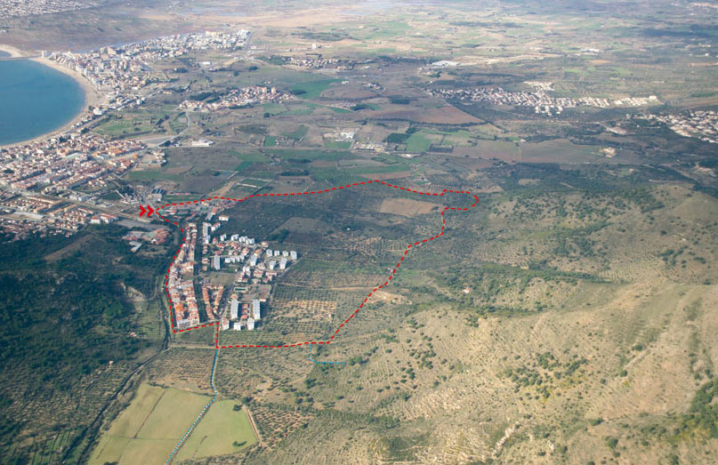 |
Route
2●
Olive trees |
|
|
|
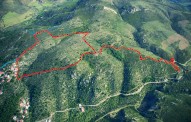 |
Megalithic
Route
3 |
APPROXIMATE DURATION » 2
hours 30 minutes -DIFFICULTY » Low -
PLACES OF INTEREST » Creu d’en
Cobertella dolmen, Casa Cremada ruins,
Casa Cremada I and II, menhirs, Llit de
la Generala dolmen, Cap de l’Home
dolmen, dry stone walls, livestock
track.
●
More information
|
|
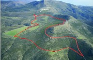 |
Route
4
●
Creus Cape & Bay of Roses |
APPROXIMATE DURATION » 2 hours 30
minutes
DIFFICULTY » Low
PLACES OF INTEREST » Mas d’en Caussa,
Pla d’en Caussa, Mas dels Arbres, Font
de la Bich, Puig Alt.
●
More information
|
|
 |
Route
5
●
Seaside path 1 |
APPROXIMATE DURATION » 2 hours 30
minutes (there & back)
DIFFICULTY » Low
PLACES OF INTEREST » Seaside path, Roses
lighthouse, Trinitat castle, Canyelles
Petites, Canyelles Grosses (Almadrava),
Punta de l’Omella, Punta de l’Ullastrell,
Els Brancs.
●
More information
|
|
 |
Route 6
●
Seaside Path
2 |
APPROXIMATE DURATION » 5 hours (there &
back)
DIFFICULTY » Medium
PLACES OF INTEREST » Seaside path,
Almadrava, Punta Falconera, bunkers, Cala
Lladó, Cala Murtra, Cala Rostella, Cap
Trencat, Cap Blanc, Calis beach , Cala
Montjoi, Mas de Montjoi de Baix, Mas de
Montjoi de Dalt, shoals, Cap Norfeu.
●
More information
|
|
|
|
|
|
|
-
- hotel costa brava, hotels costa brava,
hotel
roses, location costa brava, hotel rosas, locations
costa brava, hotels costa brava, hotels costa brava,
hotels roses, apartment costa brava, hotels roses,
holidays costa brava, rentals apartments costa
brava, apartments roses, hotels rosas
|
|